Map
Directions
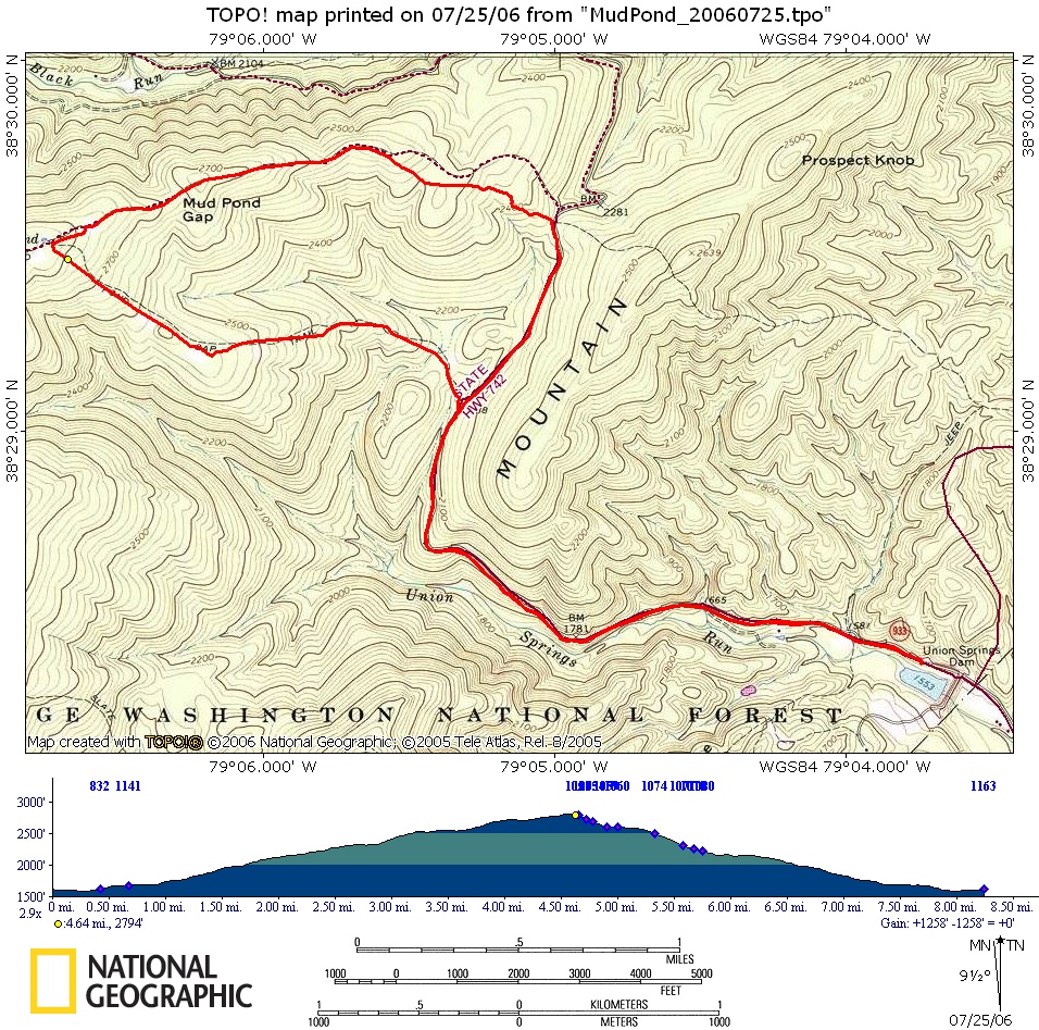
Take Route 257 W from Dayton, VA into Ottobine. At the stop-sign next to a little general store/gas staion, go straight onto Route 742 (Waggy’s Creek Rd.) and then take a left on Union Springs Dam Rd (Route 933). Most people probably park just past the dam on the left or right of the road, but you can park further up at a couple obvious pull-outs if you want to shorten the ride. The Union Springs Dam on Google Maps.
Route Description
The route climbs up a gravel road from Union Springs Dam. You’ll pass where you’ll exit later on the Mud Pond Gap trail (544), but keep going to the entrance of the Blueberry trail (544A) and go left. Climb single-track for a mile or so until you get to the 3-way intersection of Meadow Knob trail (maybe marked as 428). You might see a sign for Oak Knob. At this intersection take a left down single/double track with some fun jumps at the end. Eventually you’ll exit back to the road where you’ll take a right to get back to the Dam.